Alpha-Klima releases its improved first dataset of EU Fire Probability
Alpha-Klima Wildfire Risk v1.0
2.5 km × 2.5 km annual probabilities that at least one wildfire occurs in every grid cell across Europe (2001-2050), modelled with an explainable, monotonic-constraint XGBoost approach and two emissions pathways (RCP 4.5 & RCP 8.5).
- Coverage 36 countries • EPSG: 3035
- Scenarios Historical (2001-22) + RCP 4.5 & 8.5 (2023-50)
- License CC BY-NC 4.0 • see details
1. Introduction & Alignment with Previous Research
Alpha-Klima Wildfire Risk v1.0 provides continent-wide, high-resolution probabilities of wildfire occurrence from 2001 to 2050. The workflow builds on the single-step, monotonic-constraint methodology in ECB Statistics Paper No 49 and Burger et al. (2024).
- Meteorological drivers — annual mean and maximum Fire Weather Index (FWI) from Copernicus.
- Land-surface predictors — MODIS MCD12Q1 fractional land-cover classes.
- Anthropogenic features — distance to roads, railways, and urban areas (HARCI-EU, Geoapify).
Key similarities to Burger et al. (2024)
- Single-step occurrence modelling (no burned-area sub-model).
- Gradient-boosted trees with monotonic constraints for physical consistency.
- Europe-wide coverage at 2.5 km, including Turkey.
- Historical calibration (2001-22) plus scenario projection (2023-50).
Key differences to Burger et al. (2024)
- Urban layer— Geoapify urban extents for more significance of the distance to human settlements.
- Automated pipeline — full reproducibility with IBM Research’s CLAIMED Framework.
2. Methods
2.1 Model Inputs & Pre-processing
- Meteorology (FWI): Historical 2001-2005 plus RCP 4.5 / 8.5 projections 2005-2050; mean & max statistics (year resolution).
- Land Cover: MODIS MCD12Q1 (500 m) aggregated to 2.5 km; forest, cropland, grassland, urban fractions.
- Anthropogenic: Distance to nearest road, railway, urban area (shorter = higher ignition risk).
- Fire observations: MODIS MCD64A1 converted to binary labels (2001-23).
- Grid harmonisation: All layers at 2.5 km (EPSG 3035); missing values nearest-neighbour-filled.
2.2 Modeling Approach
- Target — binary flag: any wildfire in cell-year.
- Algorithm — XGBoost + monotonic constraints; spatial-temporal k-fold; isotonic calibration.
2.3 Bias Correction & Scaling
- Static inputs after 2022 — land cover & infrastructure frozen.
- Interpolation / resampling — bilinear (continuous) / majority or nearest-neighbour (categorical).
3. Scenario Outputs & Caveats
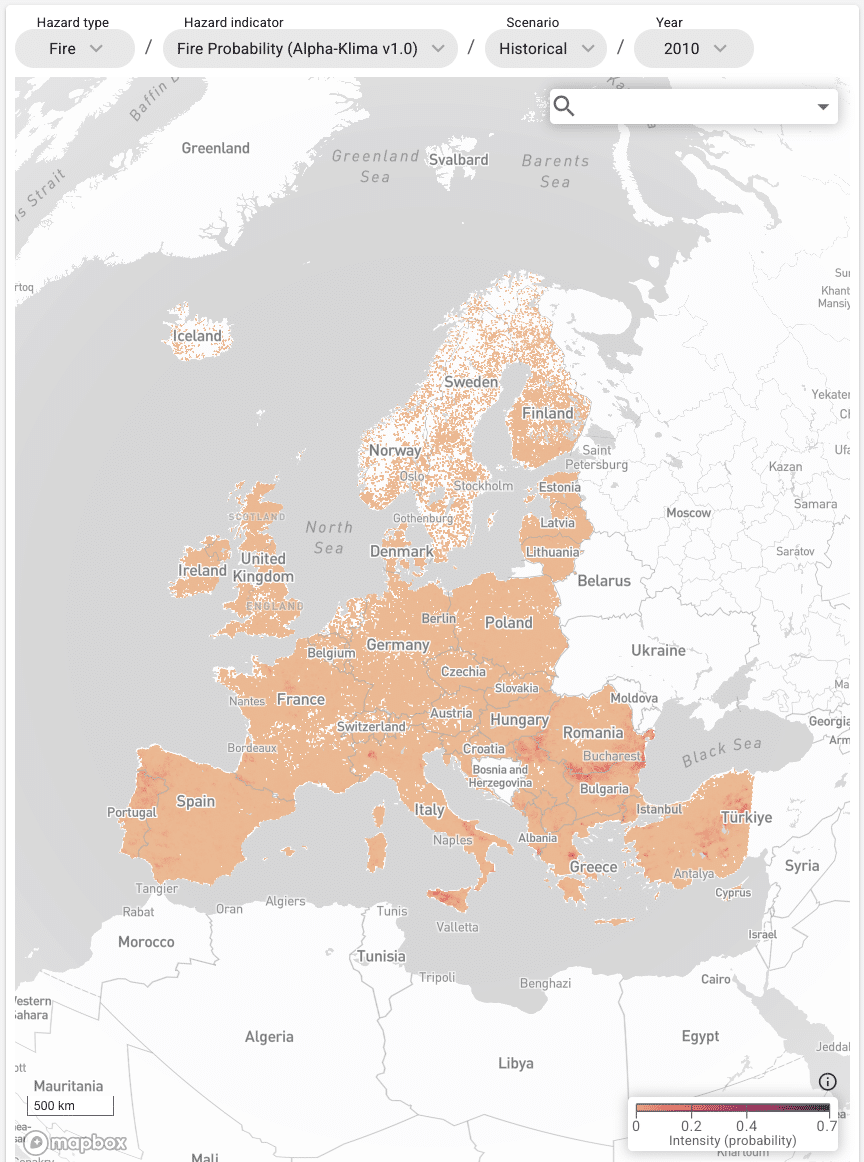
Historical (2001-22) — Model aligns with observed patterns from MCD64A1.
Forward-looking (2023-50) — RCP 4.5 & 8.5 projections indicate rising wildfire probability across the Mediterranean and parts of Central Europe, with decreases in wetter Atlantic zones.
Known limitations
- Static land cover and infrastructure beyond 2023.
- Only Historical, and RCP 4.5 & 8.5 scenarios supplied.
- Not designed for real-time emergency response.
4. Datasets Used
- Fire Weather Index (FWI) — Copernicus C3S
- Burned-area history — NASA MODIS MCD64A1
- Land-cover classification — NASA MODIS MCD12Q1
- Critical infrastructure & urban extents — HARCI-EU, Geoapify
5. Licensing & Attribution
License: CC BY-NC 4.0
Citation: Alpha-Klima (2025). Wildfire Risk for Europe under RCP 4.5 and RCP 8.5: 2001-2050 (v1.0). DOI 10.5281/zenodo.15123977
6. Contact
Alpha-Klima Team
C/ José Bardasano Baos 9, 7ºAB, 28016 Madrid, Spain
contacto@alpha-klima.com

Deja tu comentario